Python Applications in Agriculture with Global Mapping for Pests and Diseases
Meta Description:Discover how Python applications empower agriculture with global maps for pest and disease tracking, geospatial analysis, and predictive modeling to enhance crop health and food security.
Introduction
Agriculture is the backbone of global food security, yet it faces constant threats from pests and diseases. These threats not only reduce crop yields but also lead to significant economic losses for farmers worldwide. Traditional methods of pest and disease monitoring are often manual, time-consuming, and reactive, leaving farmers vulnerable to outbreaks. However, advancements in technology, particularly Python programming, are transforming agriculture.
Python, a versatile and accessible programming language, is increasingly being used to develop applications that integrate global mapping for pest and disease tracking. These applications provide real-time monitoring, predictive insights, and actionable data for farmers, researchers, and policymakers. This article explores how Python applications are driving innovation in agriculture by leveraging geospatial mapping and machine learning to tackle pest and disease challenges effectively.
Key Challenges in Agriculture Related to Pests and Diseases
Pests and diseases account for up to 40% of global crop losses annually, according to the Food and Agriculture Organization (FAO). For farmers, the impact is both financial and environmental. The overuse of pesticides, often a knee-jerk reaction to outbreaks, depletes soil health and harms ecosystems.
Traditional methods for detecting pests and diseases involve physical field inspections and historical data analysis. These methods, while effective in small-scale farming, fall short when applied to larger areas. The lack of real-time monitoring and prediction tools further exacerbates the problem. There is a pressing need for scalable, data-driven solutions, which is where Python applications come into play.
Role of Python in Agriculture
Python is uniquely suited to address agricultural challenges due to its wide range of libraries and tools for data analysis, geospatial mapping, and machine learning. Its simple syntax and extensive community support make it accessible to developers and researchers alike. Python excels in integrating diverse data sources, enabling the creation of applications that monitor pests and diseases globally.
For instance, Python can process environmental data, such as temperature, humidity, and precipitation, which are critical factors influencing pest behavior. By combining this data with satellite imagery and geospatial information, Python applications can create detailed maps highlighting pest and disease hotspots.
Building an Agricultural Application with Python
To develop an effective application for agriculture, the following components are essential:
- Data Collection: Gathering data from IoT devices, weather APIs, and global databases.
- Geospatial Mapping: Using tools like GeoPandas and Folium to visualize data on interactive maps.
- Predictive Modeling: Employing machine learning algorithms to forecast pest and disease outbreaks.
- User Interface: Designing farmer-friendly dashboards for real-time monitoring and decision-making.
Data Sources for Pest and Disease Monitoring
The foundation of any Python application in agriculture lies in the quality of its data. Several open and reliable data sources can be integrated into the application:
| Data Type | Source | Purpose |
|---|---|---|
| Climate Data | OpenWeatherMap, NASA Earthdata | Monitoring temperature, rainfall, and humidity |
| Pest/Disease Statistics | WHO, FAO | Identifying global trends |
| Satellite Imagery | Google Earth Engine, Sentinel Hub | Visualizing affected regions |
| Local Sensor Data | IoT devices installed in farms | Collecting field-specific information |
Python’s ability to seamlessly integrate these diverse datasets makes it a powerful tool for agricultural innovation.
Geospatial Mapping of Pests and Diseases
Geospatial mapping is crucial for understanding the spread of pests and diseases. With Python libraries like GeoPandas, Shapely, and Fiona, developers can process geographic data efficiently. Visualization tools like Folium and Plotly enable the creation of interactive global maps.
For instance, a Python application can use climate data to map regions with conditions favorable for specific pests. These maps can be color-coded to indicate severity levels, allowing farmers to focus on high-risk areas.
Machine Learning and Predictive Models
Machine learning adds a layer of intelligence to agricultural applications. By analyzing historical data, machine learning models can predict future pest and disease outbreaks. Python libraries like TensorFlow and scikit-learn are instrumental in building these models.
For example, a model trained on temperature and rainfall data can forecast the likelihood of locust swarms in specific regions. Such predictions empower farmers to take preventive measures, reducing crop losses significantly.
Visualization and Reporting
Clear and actionable data representation is vital for the success of any agricultural application. Python’s visualization libraries, such as Matplotlib and Seaborn, help create detailed charts and graphs. For interactive reporting, frameworks like Dash or Flask can be used.
A Python-powered dashboard might display:
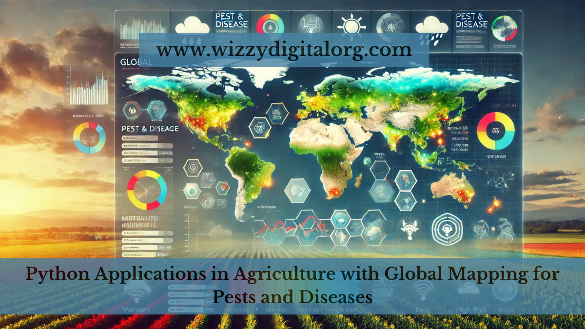
- Pest and disease hotspots on a global map.
- Historical trends in outbreaks.
- Predictions for the next farming season.
These insights are invaluable for farmers and agricultural policymakers.
Deployment of the Application
Once the Python application is developed, it needs to be deployed for practical use. Flask and Django are popular Python frameworks for building robust backends. The frontend can be designed using React or Angular, ensuring a seamless user experience.
Hosting options like AWS, Google Cloud, or Heroku offer scalable solutions for handling large datasets and user traffic. This ensures that the application remains reliable even during peak usage periods.
Benefits of the Application
Python applications with global maps for pest and disease monitoring offer numerous benefits:
- Real-Time Insights: Farmers gain access to up-to-date information, enabling timely interventions.
- Cost Efficiency: Early detection reduces the need for extensive pesticide use.
- Sustainability: Data-driven decisions promote eco-friendly farming practices.
Case Studies and Real-World Applications
Several organizations have already harnessed Python for agricultural innovation. For instance:
- The FAO’s Agricultural Stress Index System: Combines satellite data with Python-based analytics to monitor drought and pest outbreaks.
- CropIn: Uses Python for real-time agricultural monitoring, helping farmers improve productivity.
These examples highlight Python’s potential to revolutionize farming.
Challenges and Future Prospects
While Python applications offer transformative benefits, challenges remain. Integrating data from diverse sources can be complex, and adoption among small-scale farmers may be slow due to technical barriers. However, with advancements in AI and cloud computing, the future of Python in agriculture looks promising.
Conclusion
Python applications are reshaping agriculture by providing innovative solutions for pest and disease monitoring. Through global mapping, predictive modeling, and real-time visualization, these tools empower farmers to protect their crops and ensure food security. As technology continues to evolve, Python’s role in sustainable agriculture will only grow.
Let’s collaborate to harness Python’s potential in agriculture for a healthier, more secure future.
FAQs on Python Applications in Agriculture with Global Mapping for Pests and Diseases
- Can Python applications be used for crop-specific pest and disease monitoring?
Yes, Python applications can be tailored for specific crops by incorporating crop-specific data, such as growth stages, common pests, and diseases. These applications can provide targeted insights and recommendations for each crop type. - How do Python applications handle real-time data updates?
Python applications can use APIs and cloud-based data streams to fetch real-time updates. Libraries likerequestsandpandashelp in processing live data, ensuring timely alerts for farmers about changing conditions. - Are these Python applications accessible to small-scale farmers?
While the technology is scalable, accessibility can be improved by creating mobile-friendly interfaces and offering regional language support. Collaborations with local agricultural organizations can also facilitate adoption among small-scale farmers. - Can Python applications predict long-term pest and disease trends?
Yes, by analyzing historical data and environmental patterns, Python applications can use time-series forecasting techniques to predict long-term trends. This helps policymakers and researchers plan preventive measures. - What role does Python play in sustainable farming practices?
Python applications promote sustainable farming by minimizing the overuse of pesticides, optimizing resource allocation, and providing data-driven solutions for eco-friendly pest and disease management.


